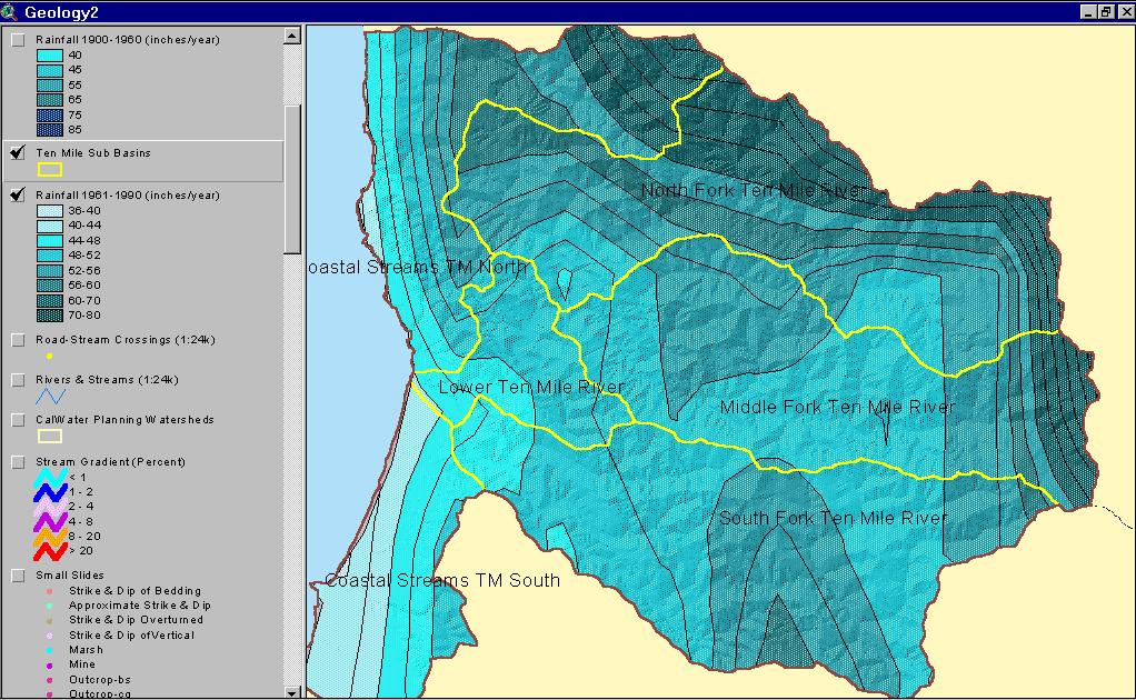
This is an isopleth map which shows the rainfall isopleths for the ten mile river watershed. The isopleths are depicted with the yellow lines which can be seen on the map. Different annual rainfall levels are shown in different shades of green on the map. The isopleths on the map are shown in ten mile sub basins. The main focus of the map is to show the annual rainfall amounts in the ten mile river watershed.
No comments:
Post a Comment